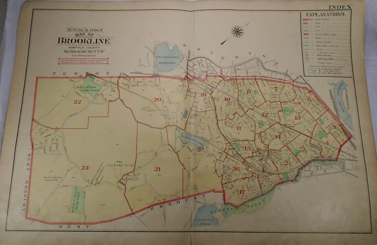
1. Map of Brookline, Norfolk County, Massachusetts. Philadelphia: G.W. Bromley & Co., 1913.
32.5x33. A complete map of the town of Brookline in colour and with extreme detail. Item #33965
32.5x33. A complete map of the town of Brookline in colour and with extreme detail. Item #33965
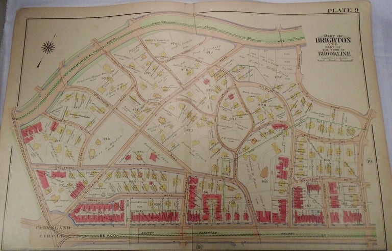
32.5x33. A partial, coloured and highly detailed map of Brookline and Brighton with Commonwealth Avenue and railway to the North, Corey Road to the East, Beacon Street and railway to the South, and Chestnut Hill/Cleveland Circle to the West. Item #33974
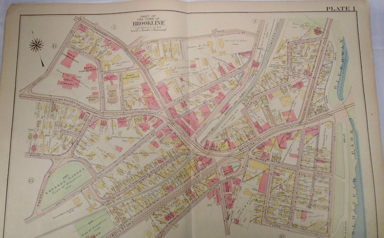
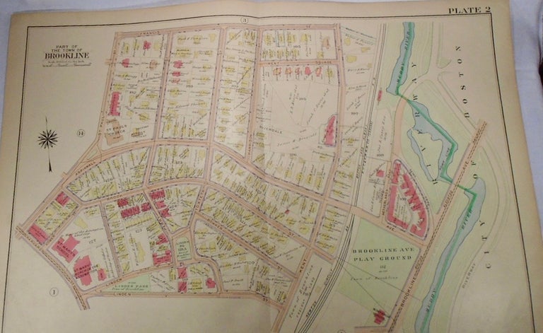
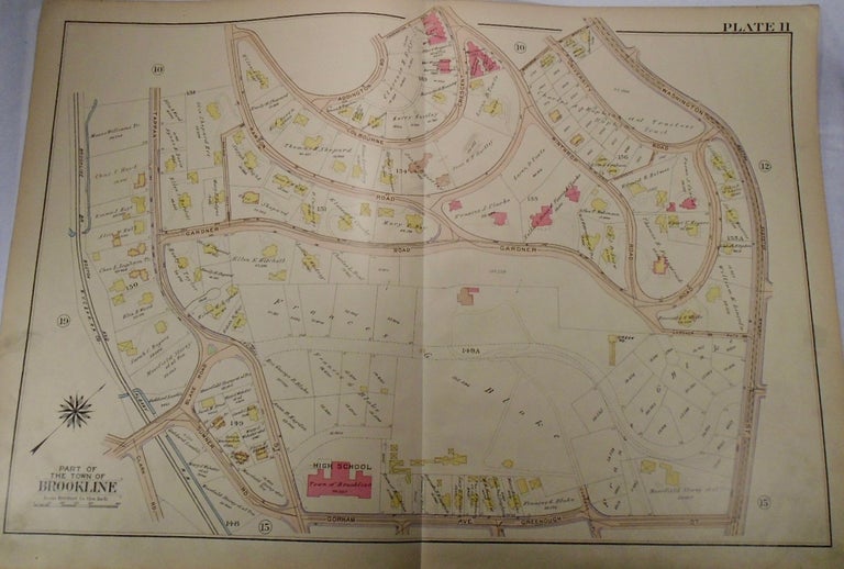
32.5x33. A partial, coloured and highly detailed map of Brookline with Harvard and Linden Streets to the North, Olmstead Park to the East, Boylston and Flora Streets to the South, and the intersection of School and Washington Streets with Emerson Garden to the West. Item #33966
32.5x33. A partial, coloured and highly detailed map of Brookline with Francis Street to the North, Brookline Avenue to the East, Linden Street and Brookline Playground to the South, and the intersection of Aspinwall and Harvard to the West. Item #33967
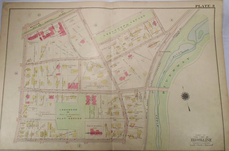
32.5x33. A partial, coloured and highly detailed map of Brookline with Beacon Street and Longwood Square to the North, Riverway to the East, Francis Street to the South, and St. Paul Street to the West. Item #33968
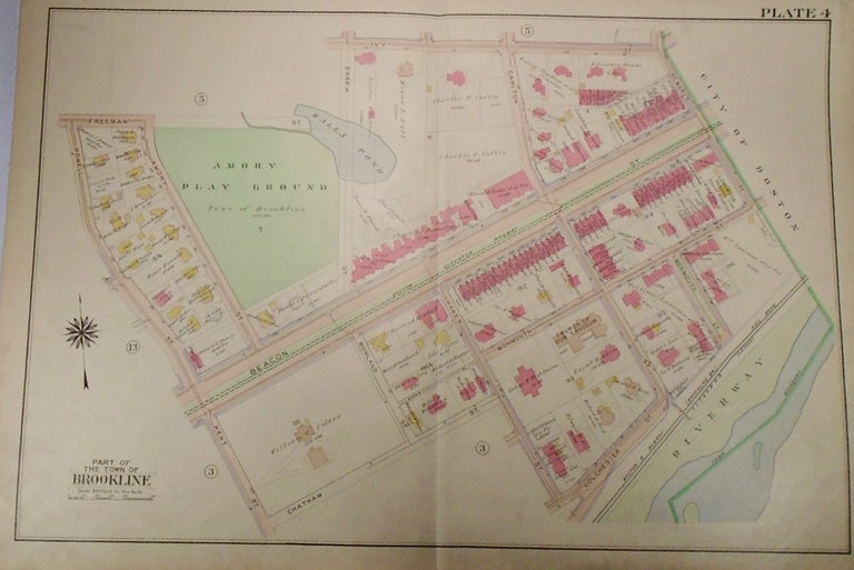
32.5x33. A partial, coloured and highly detailed map of Brookline with Ivy Street and Amory Playground to the North, St. Mary's Street and the City of Boston to the East, Chatham and Colchester Streets to the South, and Powell and Kent Streets to the West. Item #33969
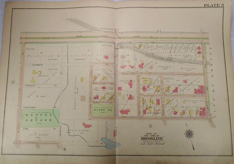
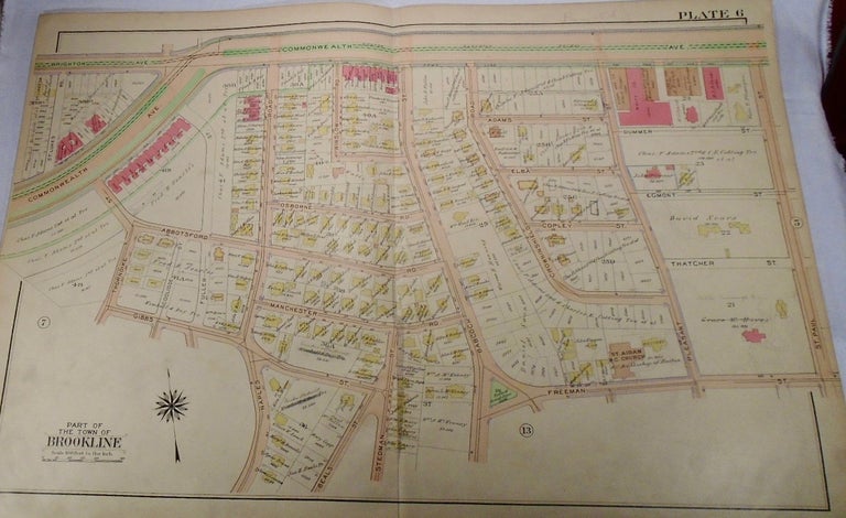
32.5x33. A partial, coloured and highly detailed map of Brookline with Commonwealth Avenue to the North, the City of Boston and St. Mary's Street to the East, Freeman and Ivy Streets to the South, and St. Paul Street to the West. Item #33970
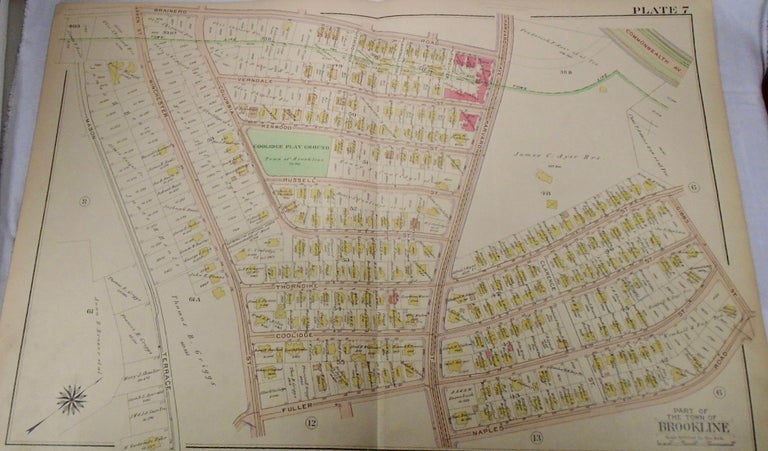
32.5x33. A partial, coloured and highly detailed map of Brookline with Brighton and Commonwealth Avenues to the North, St. Paul Street to the East, Freeman and Gibbs Streets to the South, and St Lukes and Commonwealth Avenue to the West. Some pencil marks are present on the map. Item #33971
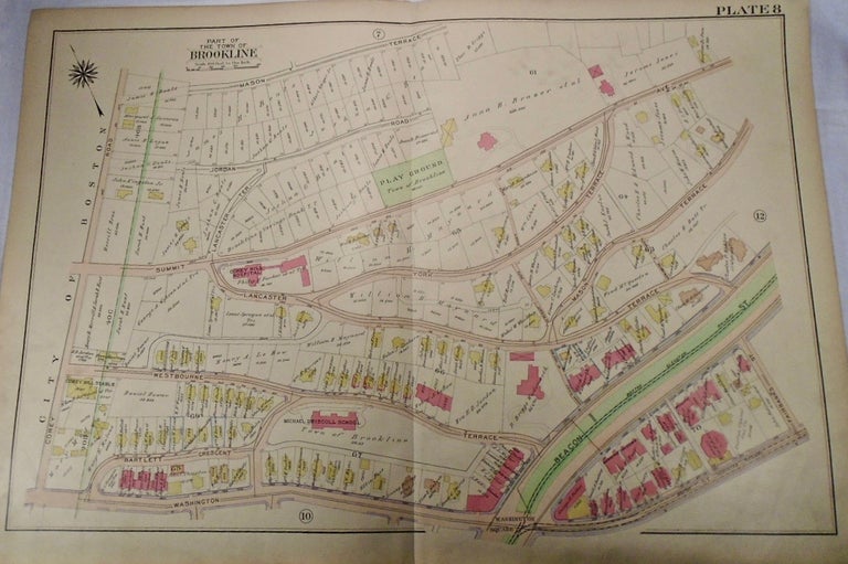
32.5x33. A partial, coloured and highly detailed map of Brookline with Brainerd Road to the North, Gibbs Street and Commonwealth Avenue to the East, Naples Road to the South, and Mason Terrace to the East. Item #33972
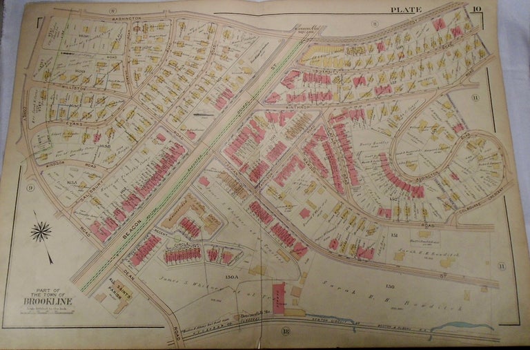
32.5x33. A partial, coloured and highly detailed map of Brookline with Mason Terrace to the North, the intersection of Beacon Street and Mason Terrace to the East, Washington Street and Square to the South, and the City of Boston to the South. Item #33973
32.5x33. A partial, coloured and highly detailed map of Brookline with Washington Street to the North, the intersection of Addington Road and Colbourne Crescent to the East, the Boston and Albany Railroad to the South, and Dean and Corey Roads to the West. A rip is present down the bottom center of the map and extends half way up the map vertically. Item #33975
32.5x33. A partial, coloured and highly detailed map of Brookline with the intersection of Rawson, Colbourne, and Addington Roads to the North, Washington Street to the East, Gorham Avenue to the South, and the Boston and Albany Railway to the West. Item #33976
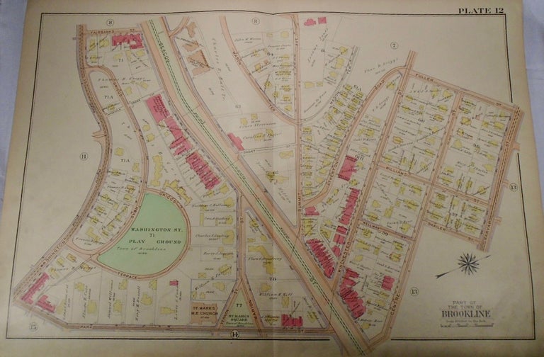
32.5x33. A partial, coloured and highly detailed map of Brookline with Fairbanks and Fuller Streets to the North, Harvard and Centre Streets to the East, Park Street to the South, and Washington Street to the West. Item #33977
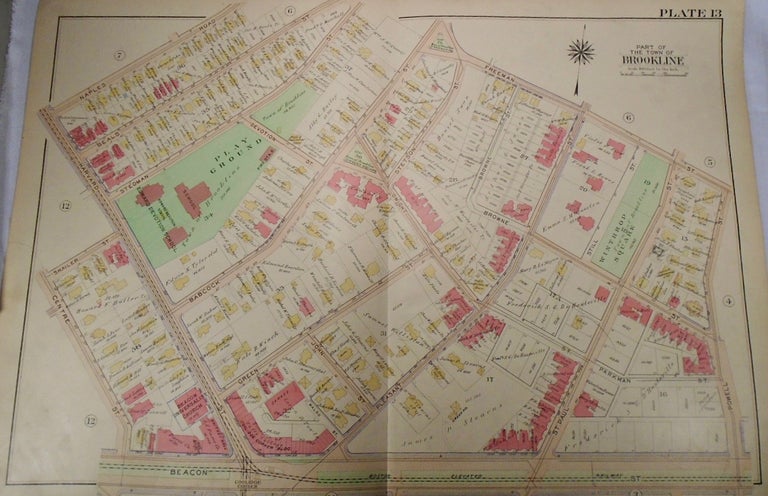
32.5x33. A partial, coloured and highly detailed map of Brookline with Naples Road and Freeman Street to the North, Powell Street to the East, Beacon Street to the South, and Harvard and Centre Streets to the West. Item #33978
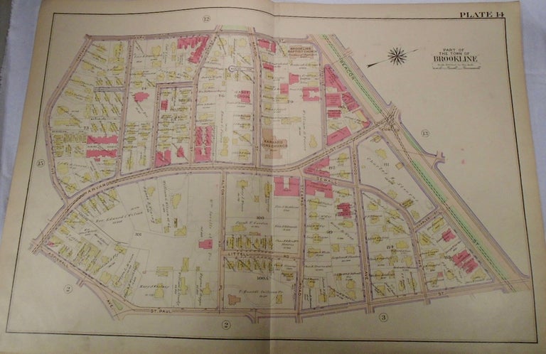
32.5x33. A partial, coloured and highly detailed map of Brookline with Park Street to the North, Beacon Street to the East, St. Paul Street to the South, and Harvard Avenue to the West. Some pencil marks are present, but very minor. Item #33979
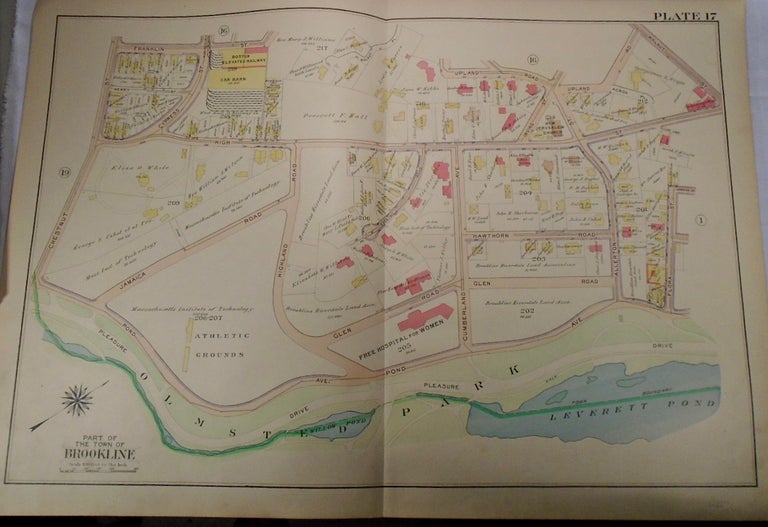
32.5x33. A partial, coloured and highly detailed map of Brookline with Gorham Avenue to the North, Harvard Avenue to the East, Emerson Street to the South, and the Boylston Street/Clark Road intersection to the West. Item #33980
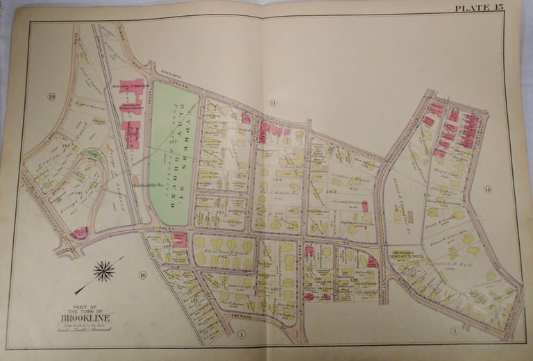
32.5x33. A partial, coloured and highly detailed map of Brookline with the intersection of Cypress and Boylston Streets to the North, Irving Street to the East, Franklin Street and Upland Road to the South, and Chestnut Street and Place to the South. Some fingerprints are present on the map but are very minor. Item #33981
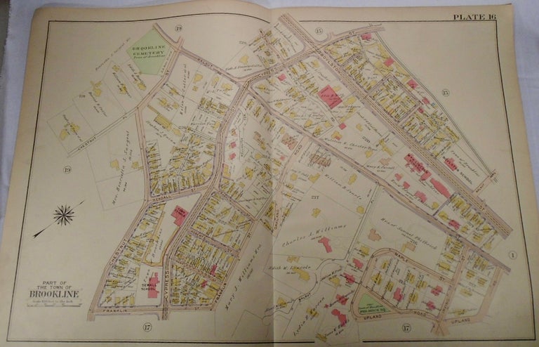
32.5x33. A partial, coloured and highly detailed map of Brookline with M.I.T. represented. Upland Road is to the North, Flora and Walnut Streets to the East, Olmstead Park to the South, and Chestnut Street to the West. Item #33982
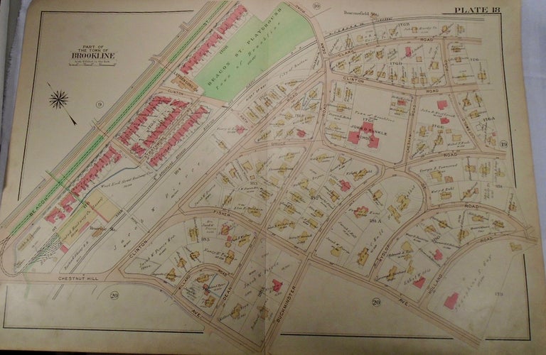
32.5x33. A partial, coloured and highly detailed map of Brookline with Clark Road and Beacon Street to the North, Holland and Cotswold Roads to the East, Chestnut Hill Avenue to the South, and the Beacons Street and Chestnut Hill intersection to the West. Two instances of pencil marks to this map, however they are very minor. Item #33983
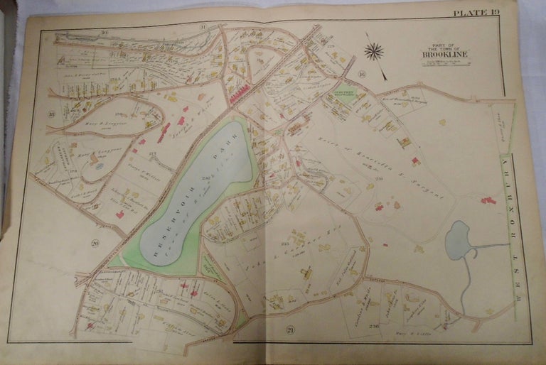
32.5x33. A partial, coloured and highly detailed map of Brookline with Reservoir Park. Clark Road and Chestnut Street to the North, West Roxbury to the East, Lee and Cottage Streets to the South, and private land to the West of Boylston Street. Item #33984
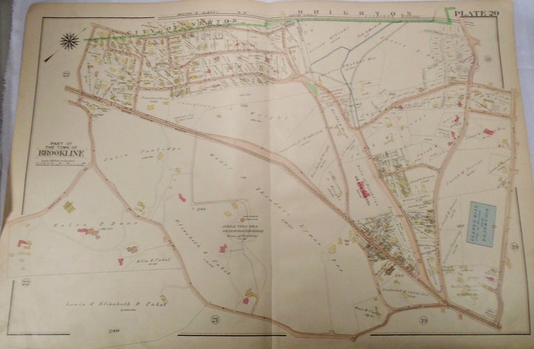
32.5x33. A partial, coloured and highly detailed map of Brookline with the cities of Newton and Brighton from the North, Fisher Avenue to the East, Heath Street to the South, and Woodland Road to the West. Item #33985
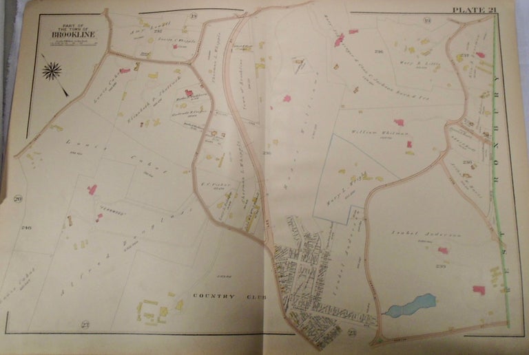
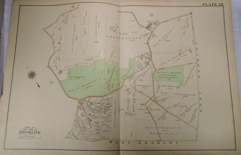
32.5x33. A partial, coloured and highly detailed map of Brookline with Warren and Cottage Streets to the North, West Roxbury to the East, Brookline Country Club to the South, and Heath Street with the Country Club to the West. Item #33986
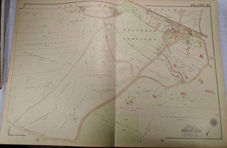
32.5x33. A partial, coloured and highly detailed map of Brookline with the city of Newton to the North, the intersection of Heath Street and Woodland Road to the East, Newton Street to the South, and private land beyond Woodland Road and the Holyhood cemetery present to the West. Item #33987
32.5x33. A partial, coloured and highly detailed map of Brookline with Clyde, Newton, and Heath Streets to the North, West Roxbury to the East and South, and the intersection of Woodland Road and Hammond Street to the West. Item #33988
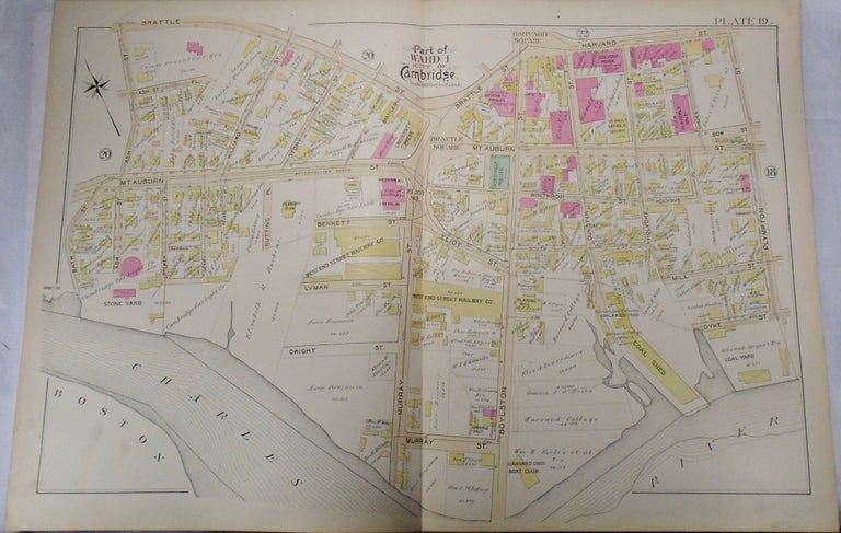
32.5x 33. A partial, coloured and highly detailed map of Cambridge's Ward 1 with Brattle Square and Street and Harvard Sqaure and Street to the North, Plympton Street to the East, the Charles River to the South, and Bath and Ash Streets to the West. Item #34008