


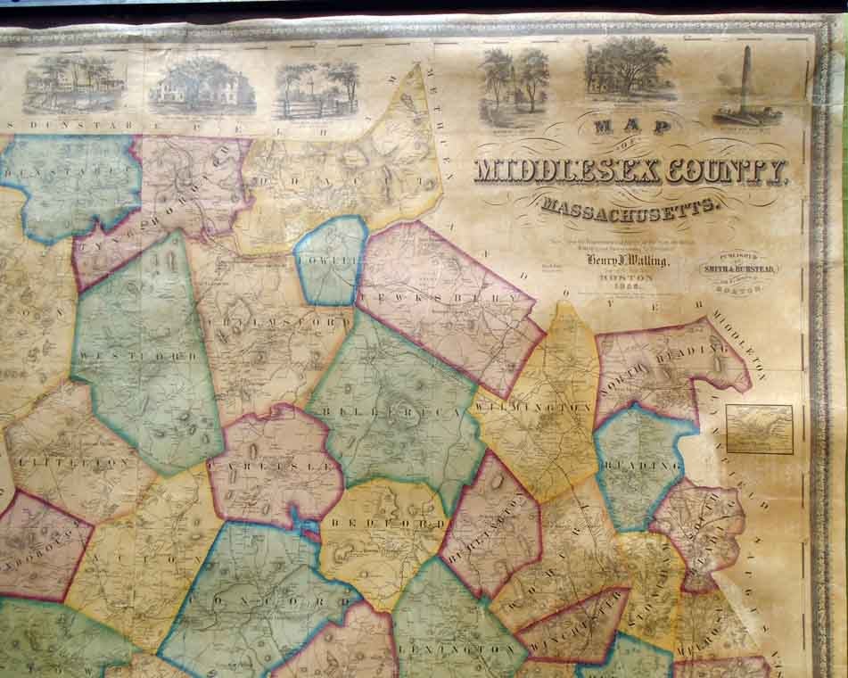
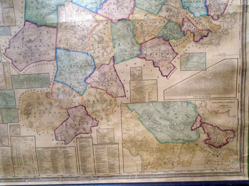
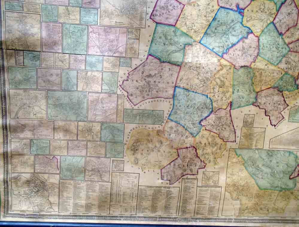
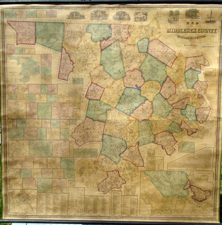
Map of Middlesex County, Massachusetts. Boston: Smith and Bumstead, 1856.
By Henry Francis Walling. Lithographed wall map with rollers, in full vibrant colors. Map of Middlesex County with 69 inset town plans showing streets and even individual dwelling places. 58.3 inches wide by 60.3 inches long (plus margins) (148.1 x 153.2 cm). Wall map in excellent condition and very recently backed on new linen by Green Dragon Bindery. References include Phillips, A List of Maps of America, p. 429, and Ristow, American Maps and Mapmakers, chapter 20, Henry Francis Walling. Scarce wall map.
Price: $3,500.00
See all items in
Maps
See all items by Henry Francis WALLING