


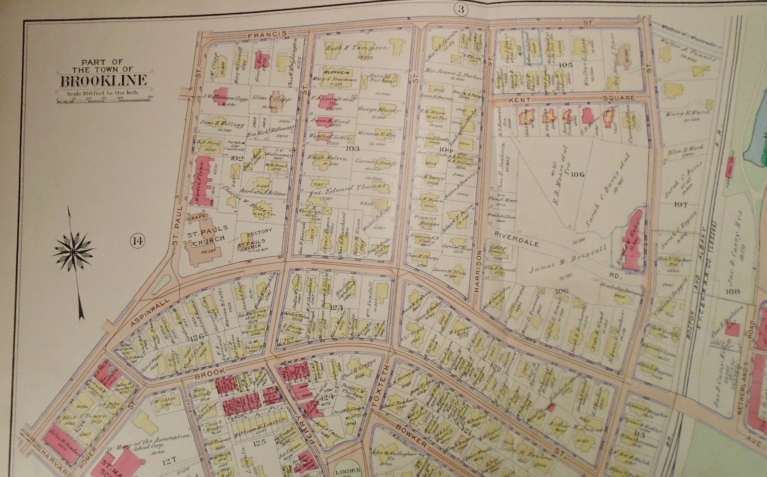
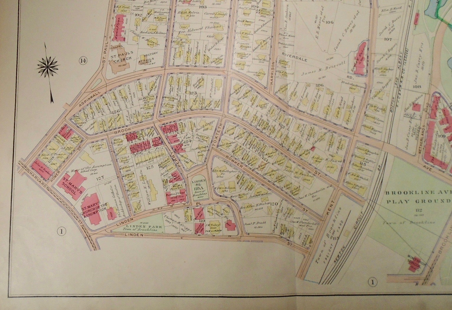
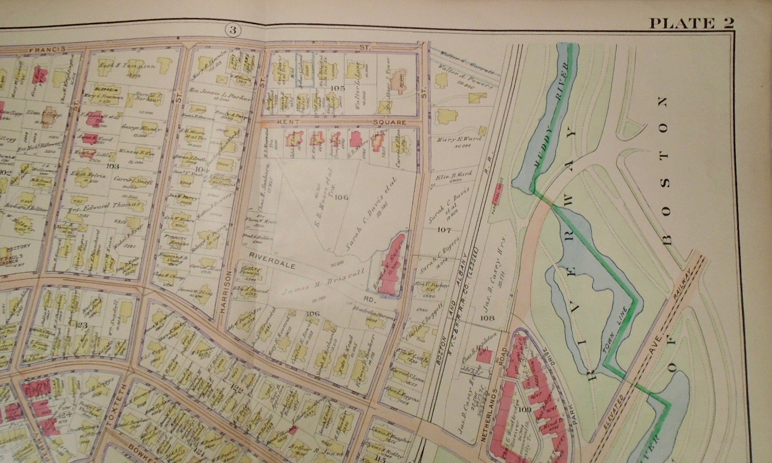
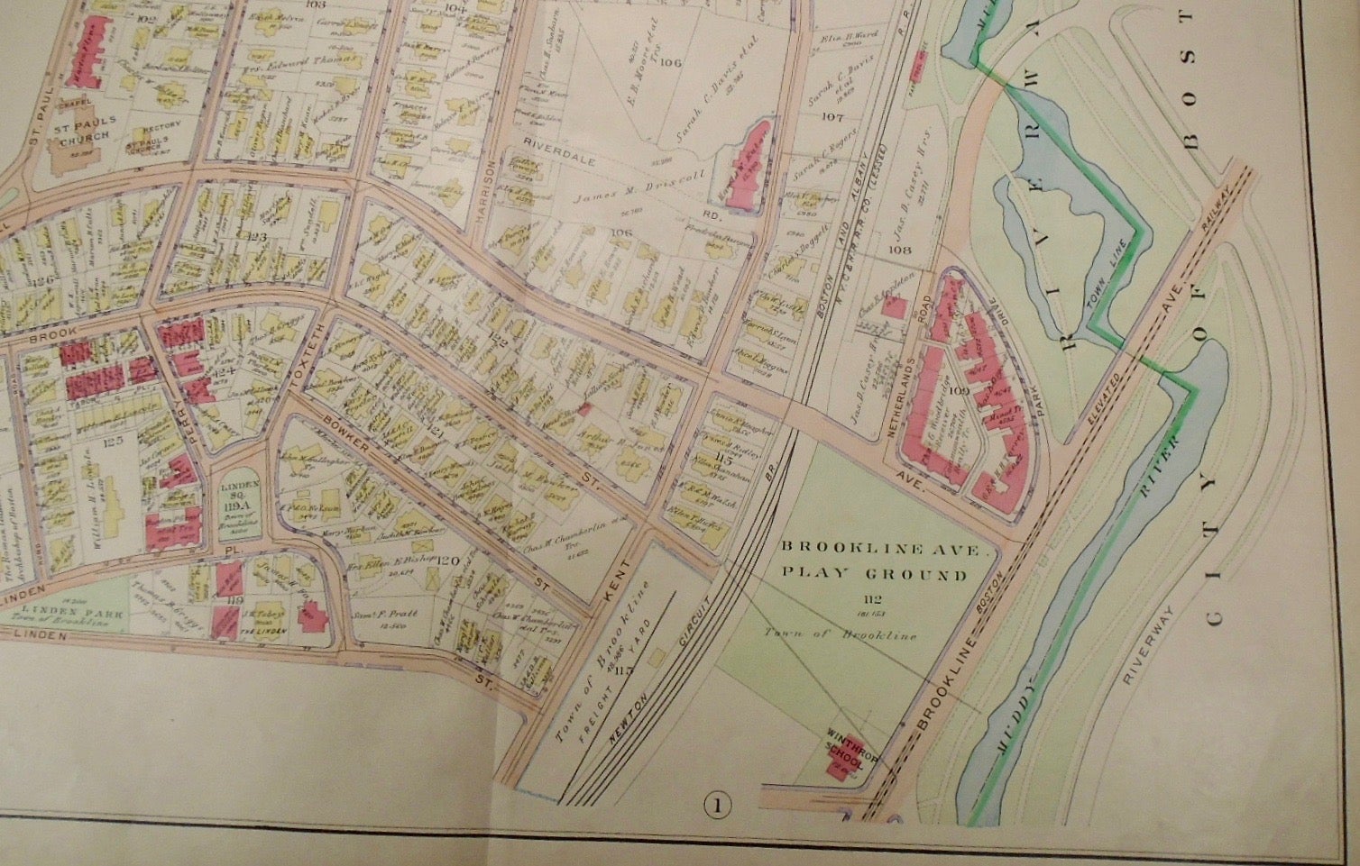
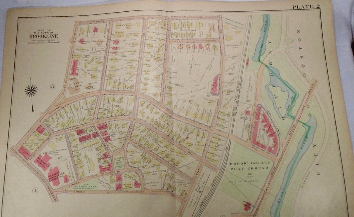
Map of Part of Brookline, Massachusetts. Philadelphia: G.W. Bromley & Co., 1913.
32.5x33. A partial, coloured and highly detailed map of Brookline with Francis Street to the North, Brookline Avenue to the East, Linden Street and Brookline Playground to the South, and the intersection of Aspinwall and Harvard to the West.
Price: $100.00
See all items in
map
See all items by G. W. BROMLEY