


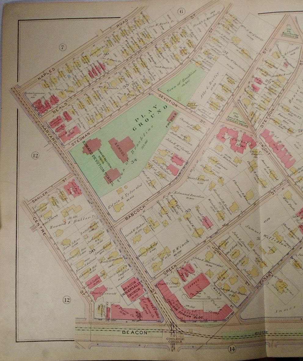
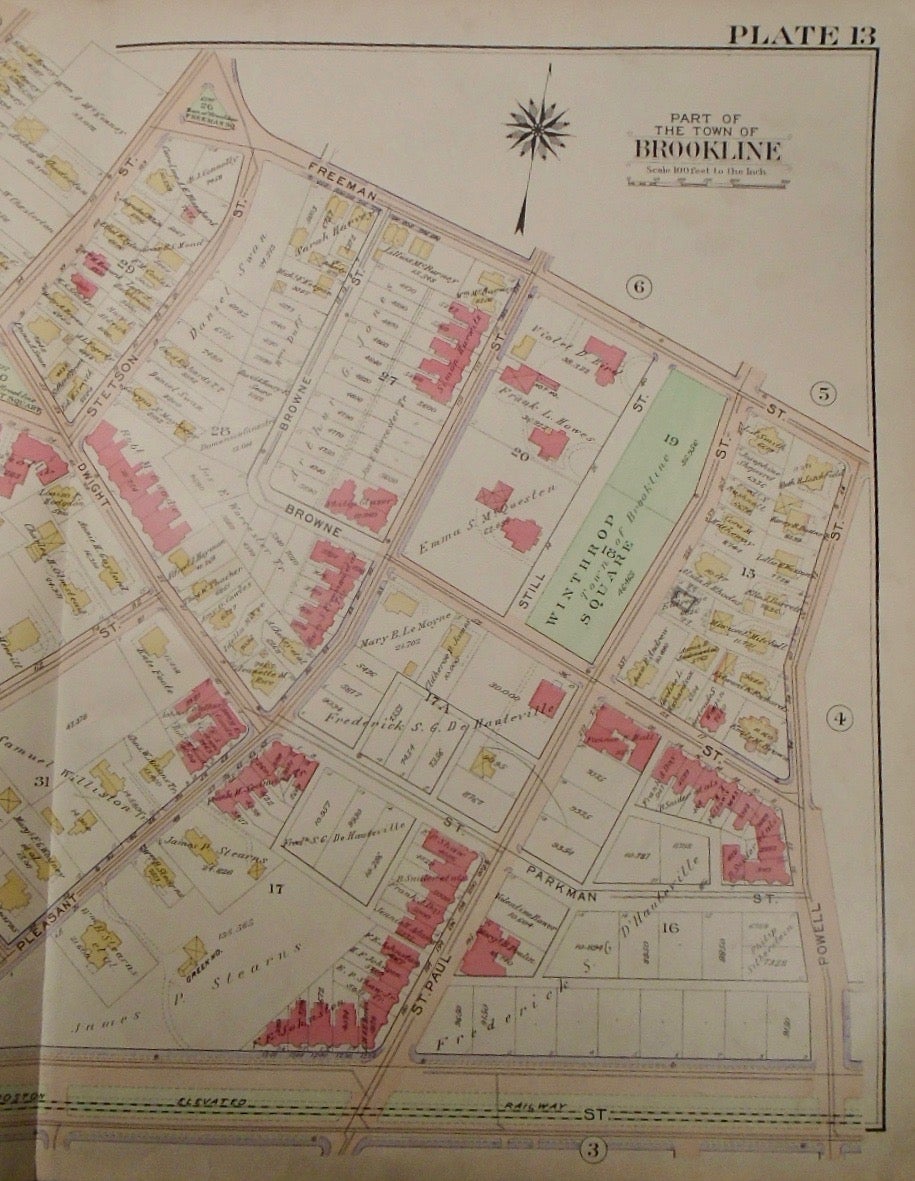
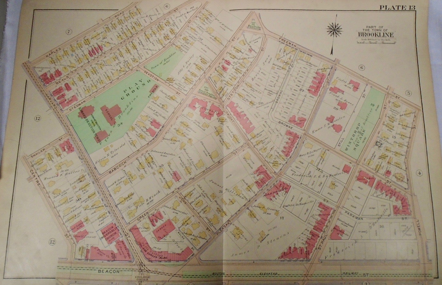
Map of Part of Brookline, Massachusetts. Philadelphia: G.W. Bromley & Co., 1913.
32.5x33. A partial, coloured and highly detailed map of Brookline with Naples Road and Freeman Street to the North, Powell Street to the East, Beacon Street to the South, and Harvard and Centre Streets to the West.
Price: $100.00
See all items in
map
See all items by G. W. BROMLEY