


Map of Part of Brookline, Massachusetts. Philadelphia: G.W. Bromley & Co., 1913.
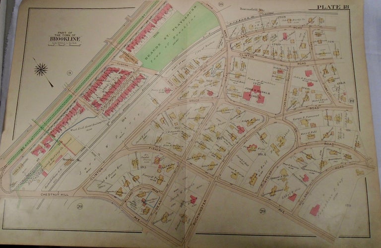
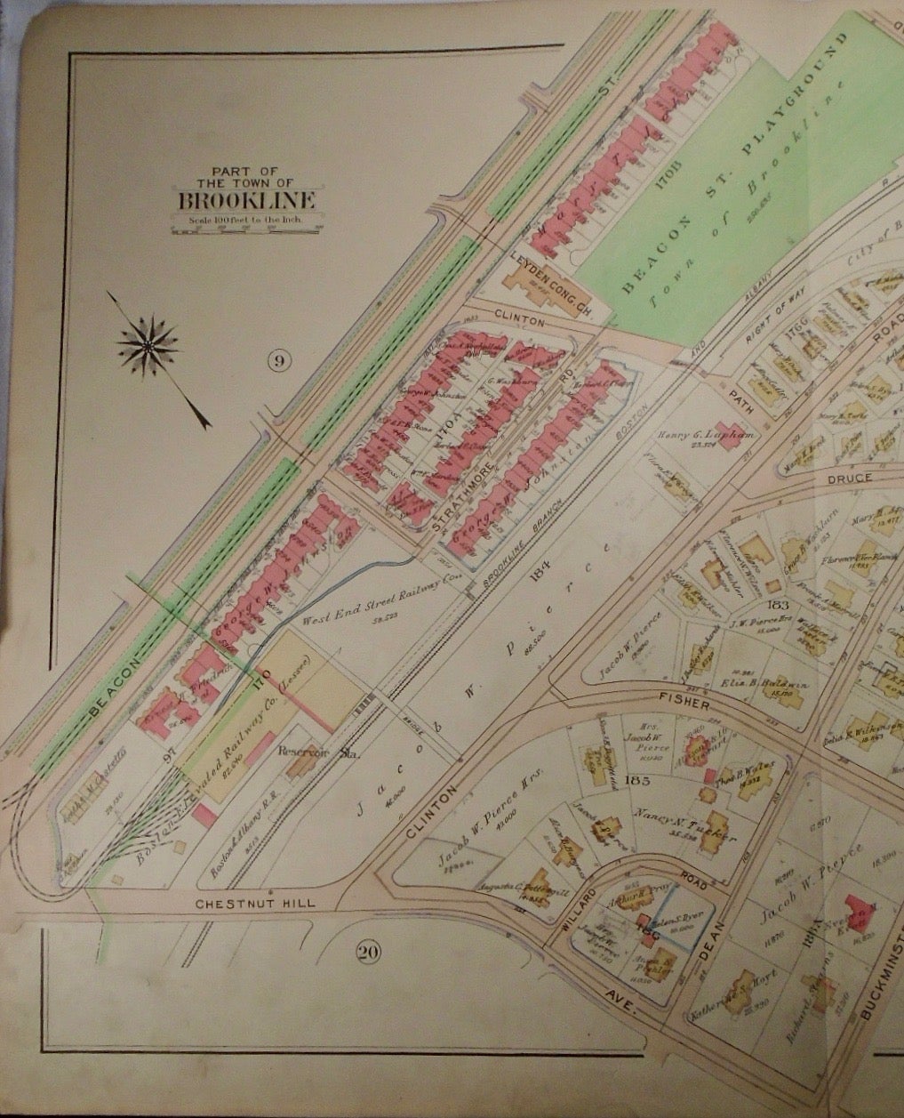
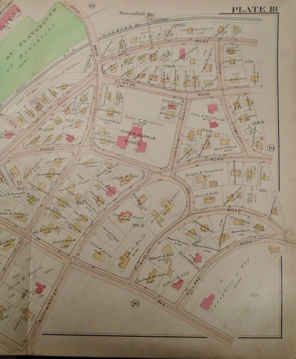
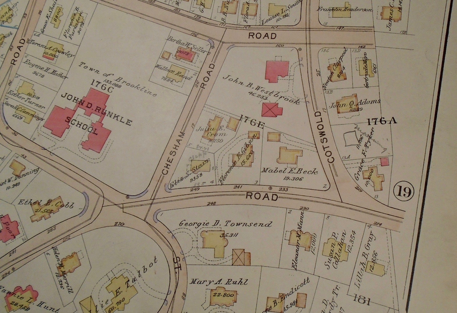
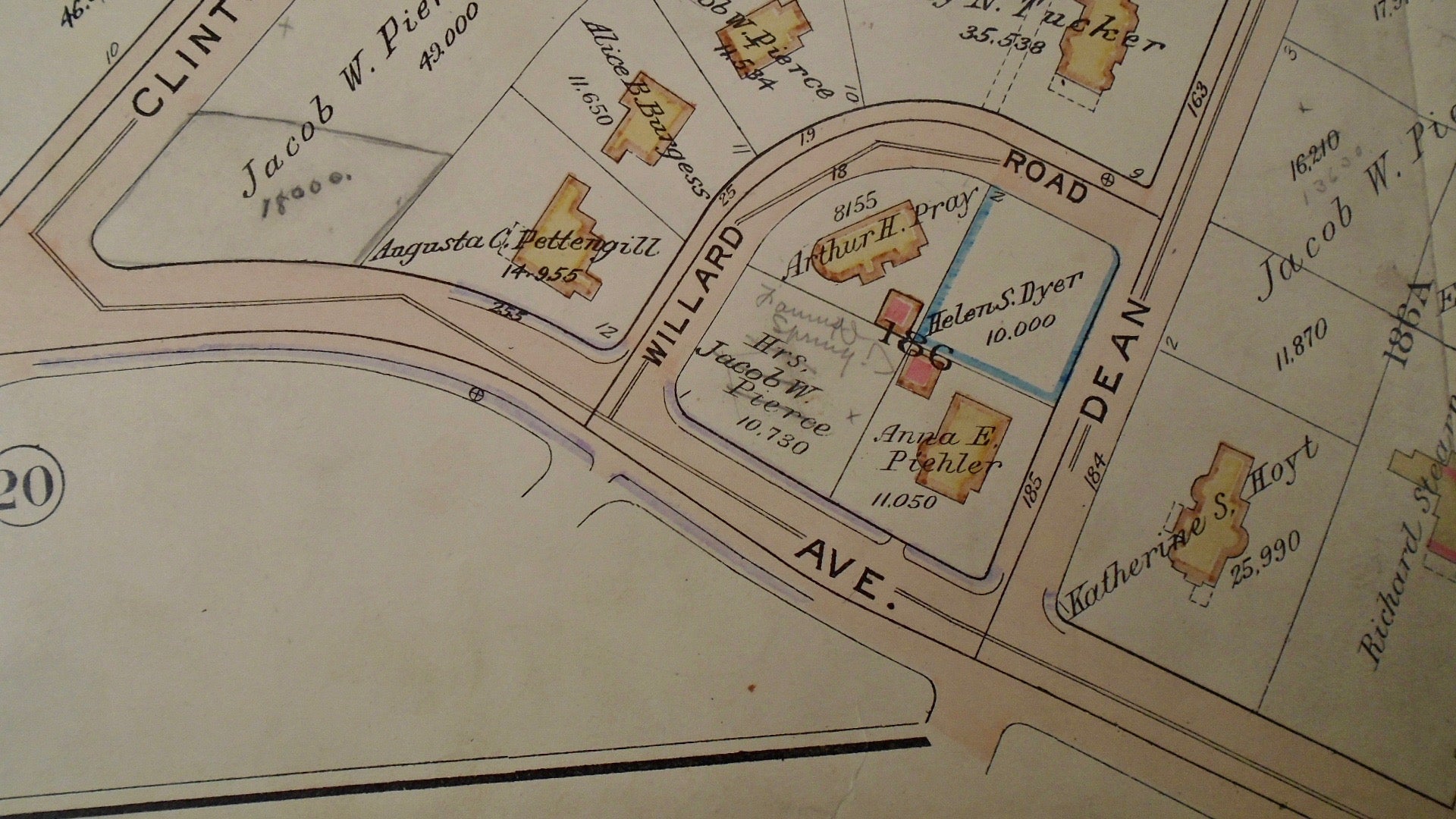
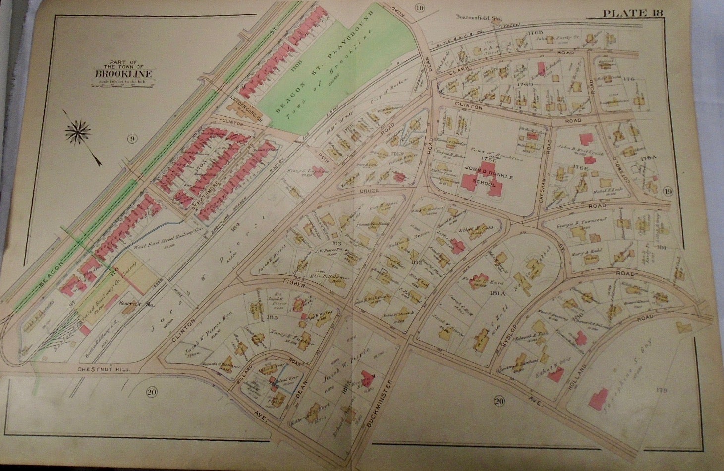
32.5x33. A partial, coloured and highly detailed map of Brookline with Clark Road and Beacon Street to the North, Holland and Cotswold Roads to the East, Chestnut Hill Avenue to the South, and the Beacons Street and Chestnut Hill intersection to the West. Two instances of pencil marks to this map, however they are very minor.
Price: $100.00
See all items in
map
See all items by G. W. BROMLEY