


![Item #35567 Smith's Map of Hartford County [Connecticut] [Wall Map]. E. M. WOODFORD.](https://yesterdaysgallery.cdn.bibliopolis.com/pictures/35567.jpg?width=768&height=1000&fit=bounds&auto=webp&v=1571359632)
![Smith's Map of Hartford County [Connecticut] [Wall Map]](https://yesterdaysgallery.cdn.bibliopolis.com/pictures/35567_2.jpg?auto=webp&v=1571359632)
![Smith's Map of Hartford County [Connecticut] [Wall Map]](https://yesterdaysgallery.cdn.bibliopolis.com/pictures/35567_3.jpg?auto=webp&v=1571359632)
![Smith's Map of Hartford County [Connecticut] [Wall Map]](https://yesterdaysgallery.cdn.bibliopolis.com/pictures/35567_4.jpg?auto=webp&v=1571359632)
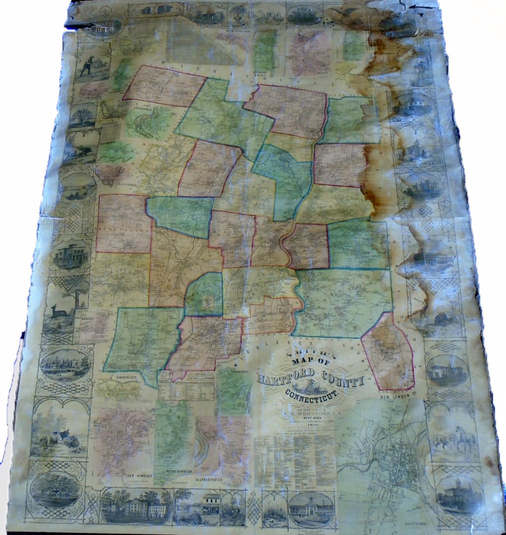
Smith's Map of Hartford County [Connecticut] [Wall Map]. Philadelphia: H. ad C. T. Smith, 1855.
55 1/2 by 69 1/2 inches. Unrestored. Includes views and landmarks at border including the State House, the Charter Oak, a Silk Factory, etc. Good, stain at right side, eight inch tear upper left (mostly closed), some fraying upper right, one roller pole half detached.
Price: $600.00
See all items in
Maps
See all items by E. M. WOODFORD