


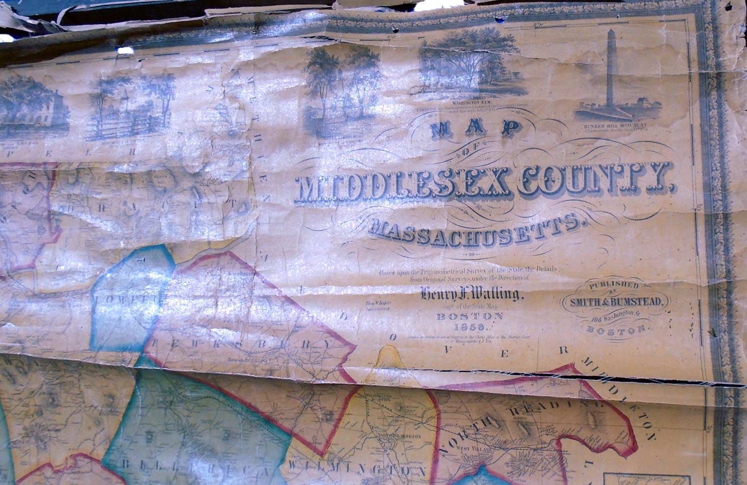
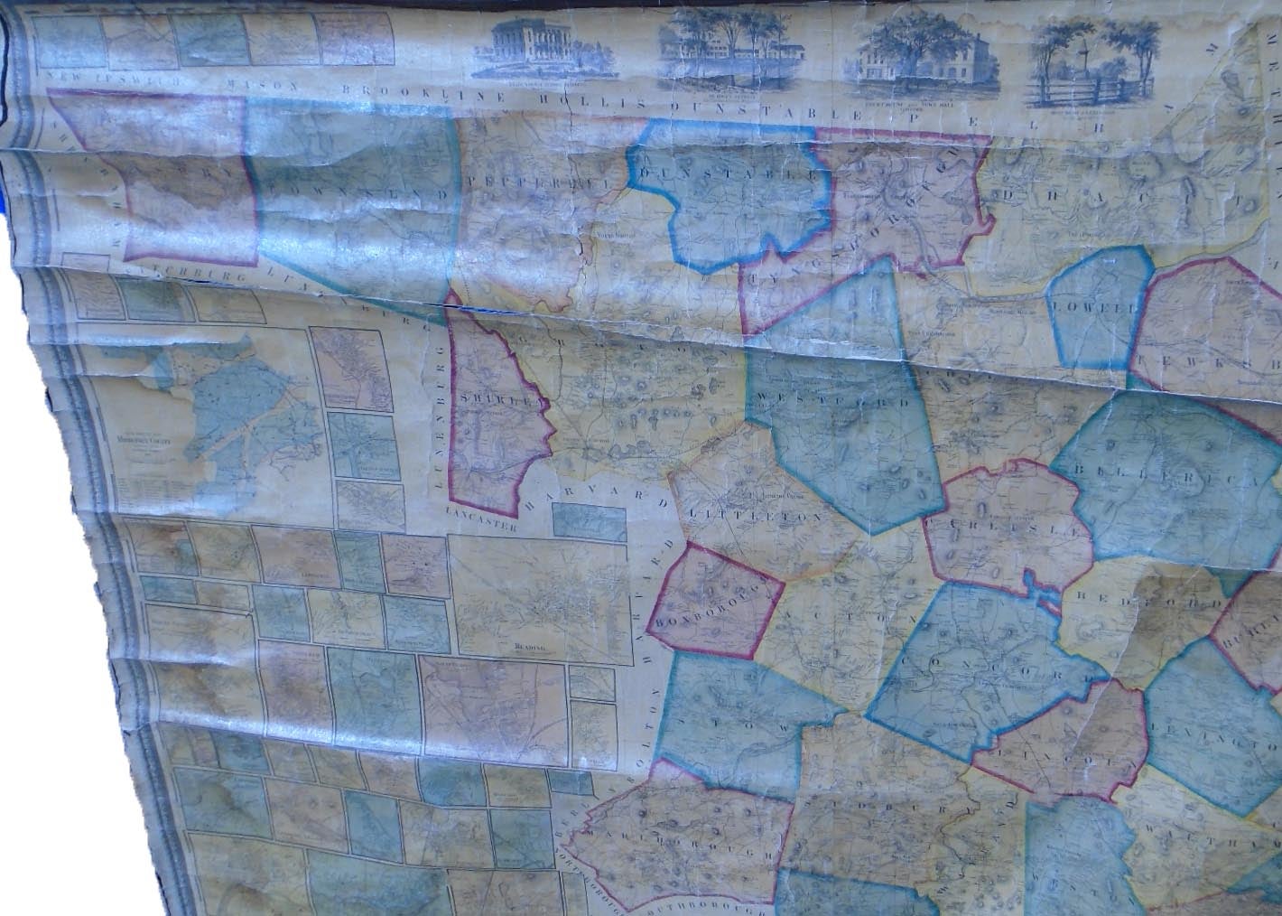
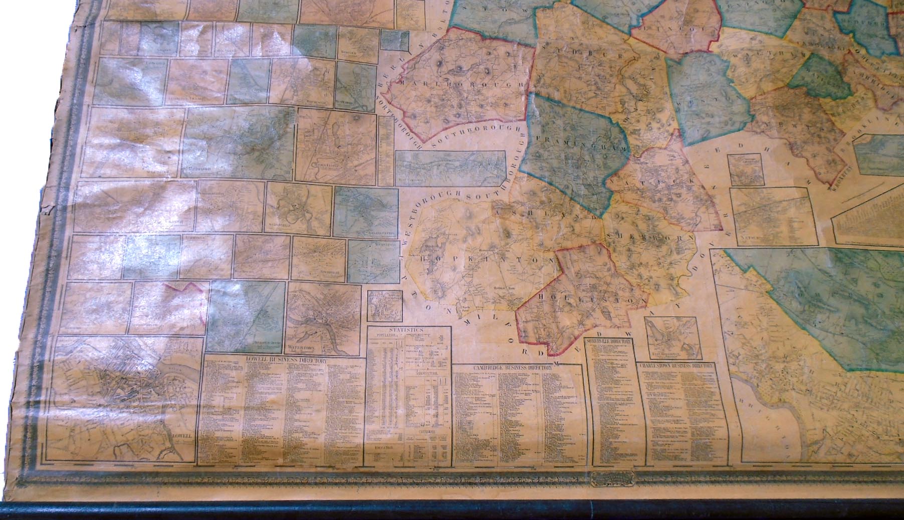
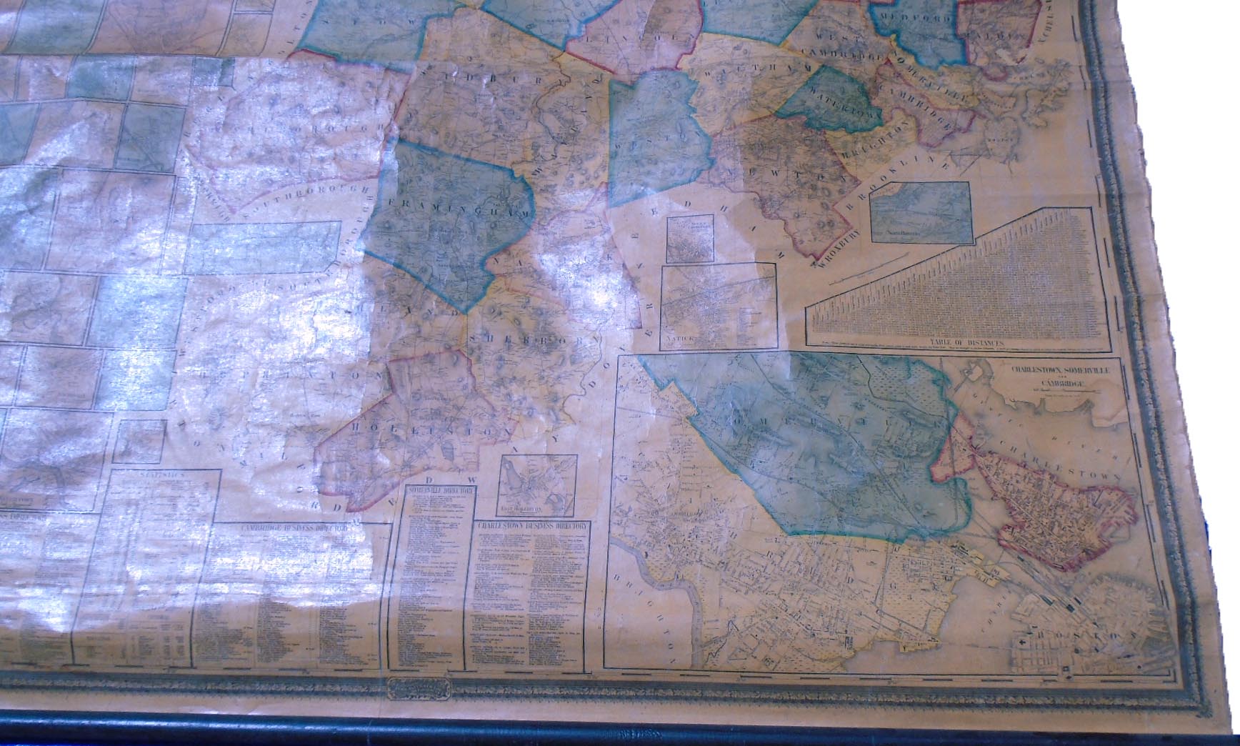
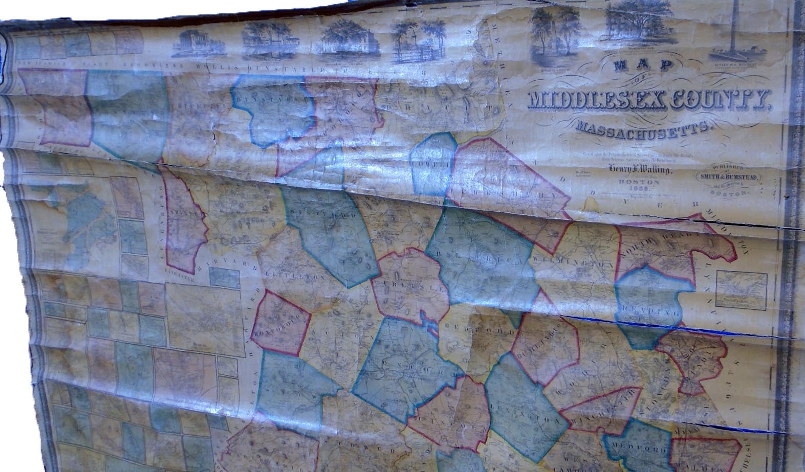
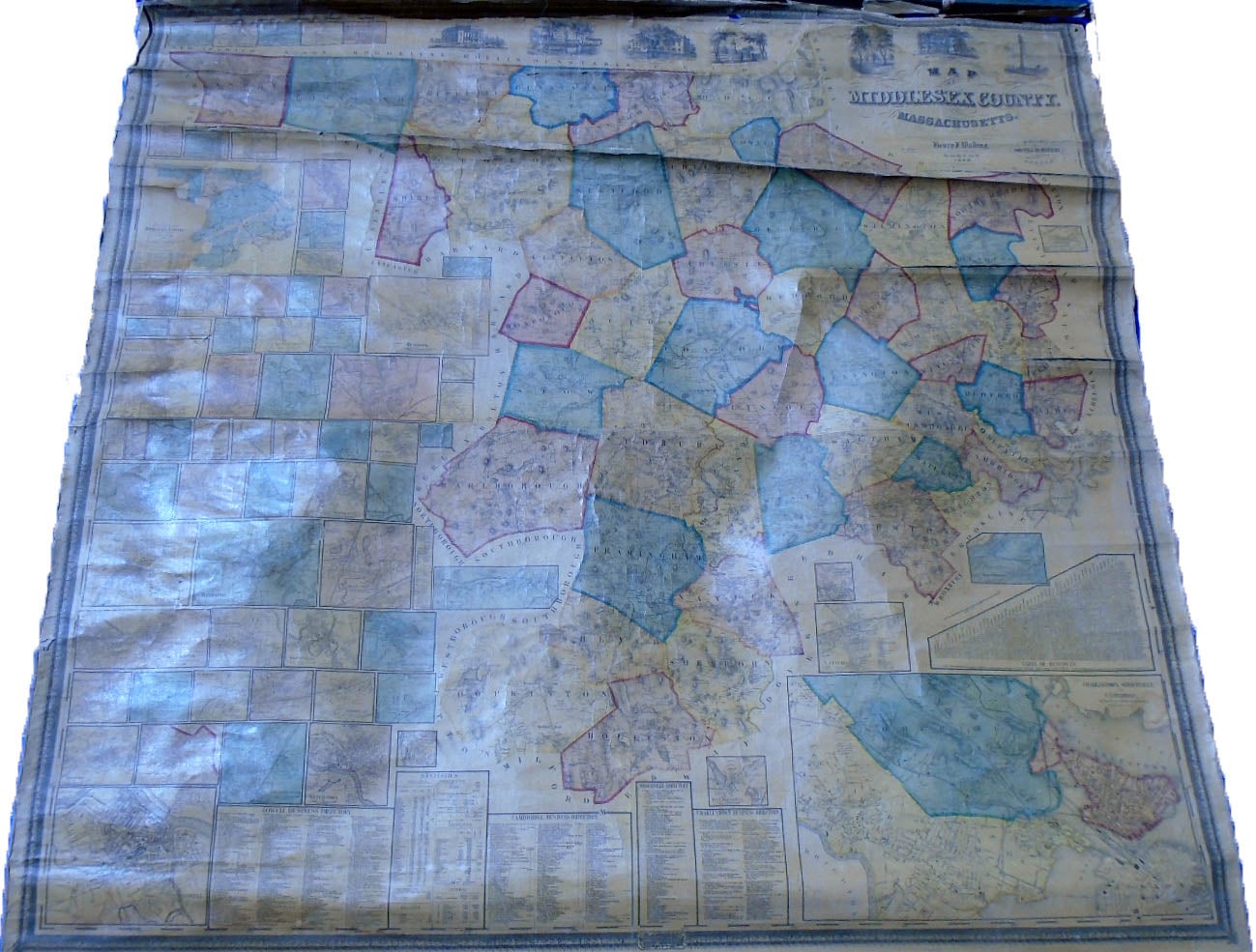
Map of Middlesex County. Boston: Smith and Bumstead, 1856.
Original wall map, 61 1/2 by 59 inches. Lithographed wall map with rollers, in full vibrant colors. Map of Middlesex County with 69 inset town plans showing streets and even individual dwelling places. References include Phillips, A List of Maps of America, p. 429, and Ristow, American Maps and Mapmakers, chapter 20, Henry Francis Walling. Scarce wall map. Good, top roller detached, several long closed splits, stain left top side.
Price: $2,250.00
See all items in
Maps
See all items by Henry Francis WALLING