


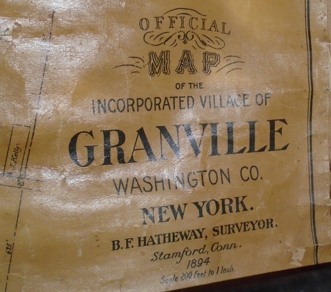
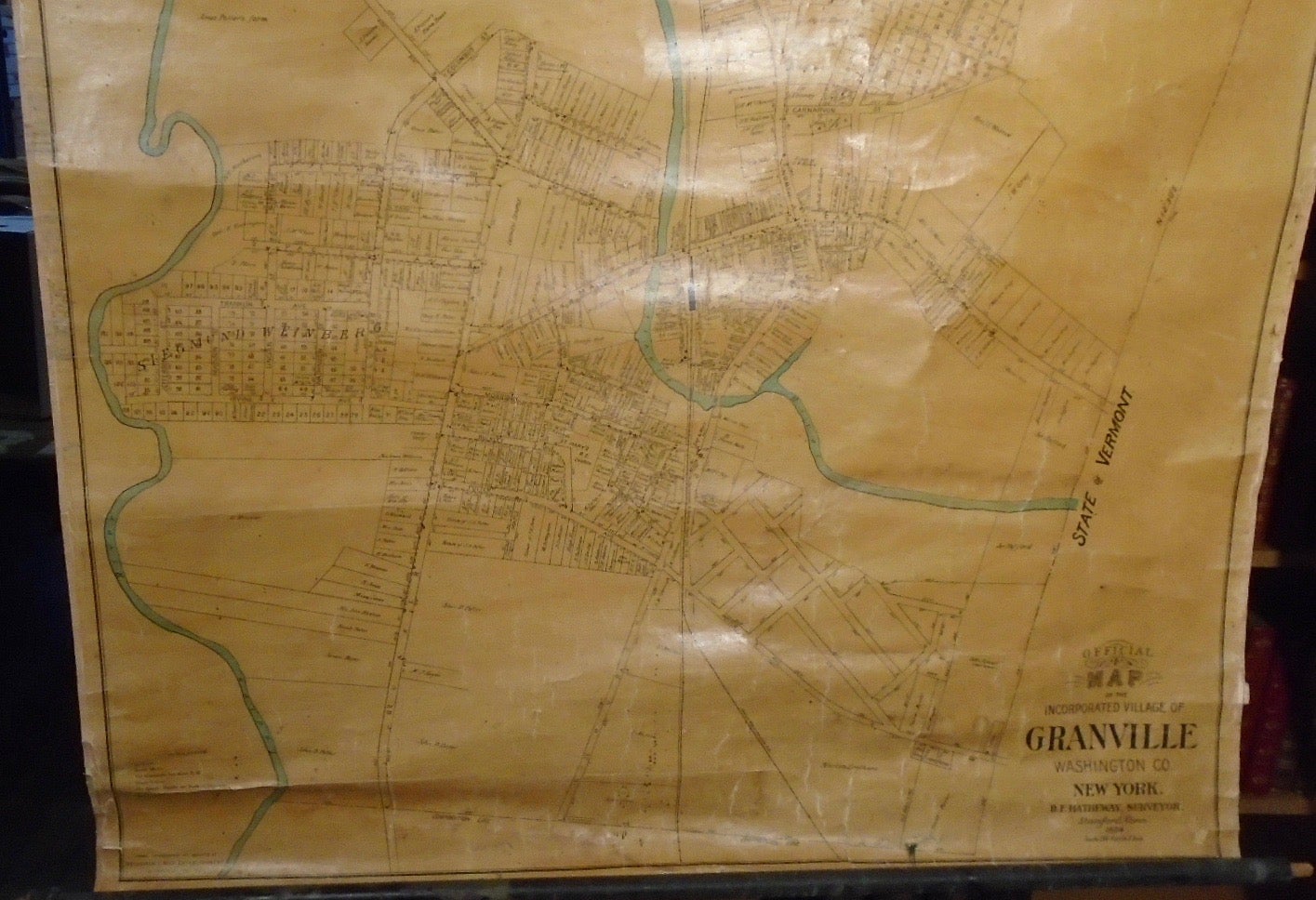
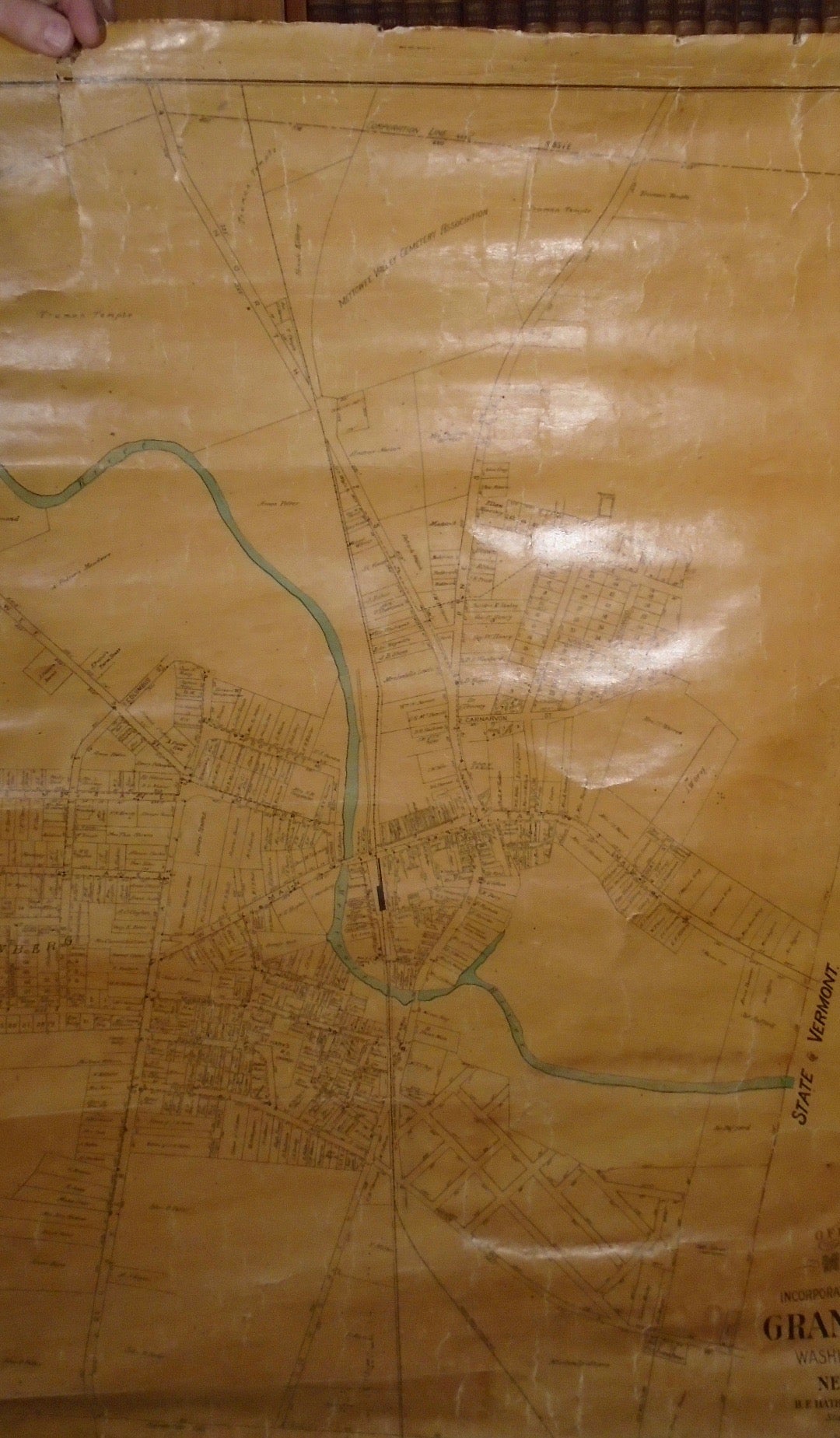
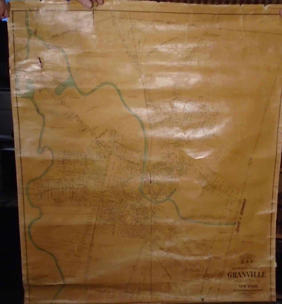
Official Map of the Incorporated Village of Granville, Washington Co. New York. Stamford, Connecticut. New York: B. F. Hatheway, Surveyor, 1894.
41.5 by 36.75 inches. Drawn, Lithographed and mounted at Bridgman’s Map Establishment. Very Good. Four inch closed tear upper left corner; top roller detached but present; bottom roller 1/3 detached but present. Very small hole upper left corner. Lightly frayed on edges, not affecting the image. Shows two rivers; borders the state of Vermont.
Price: $650.00
See all items in
Maps