


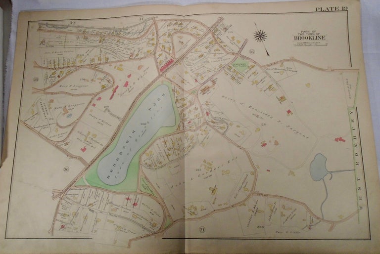
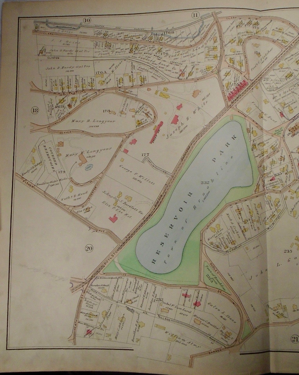
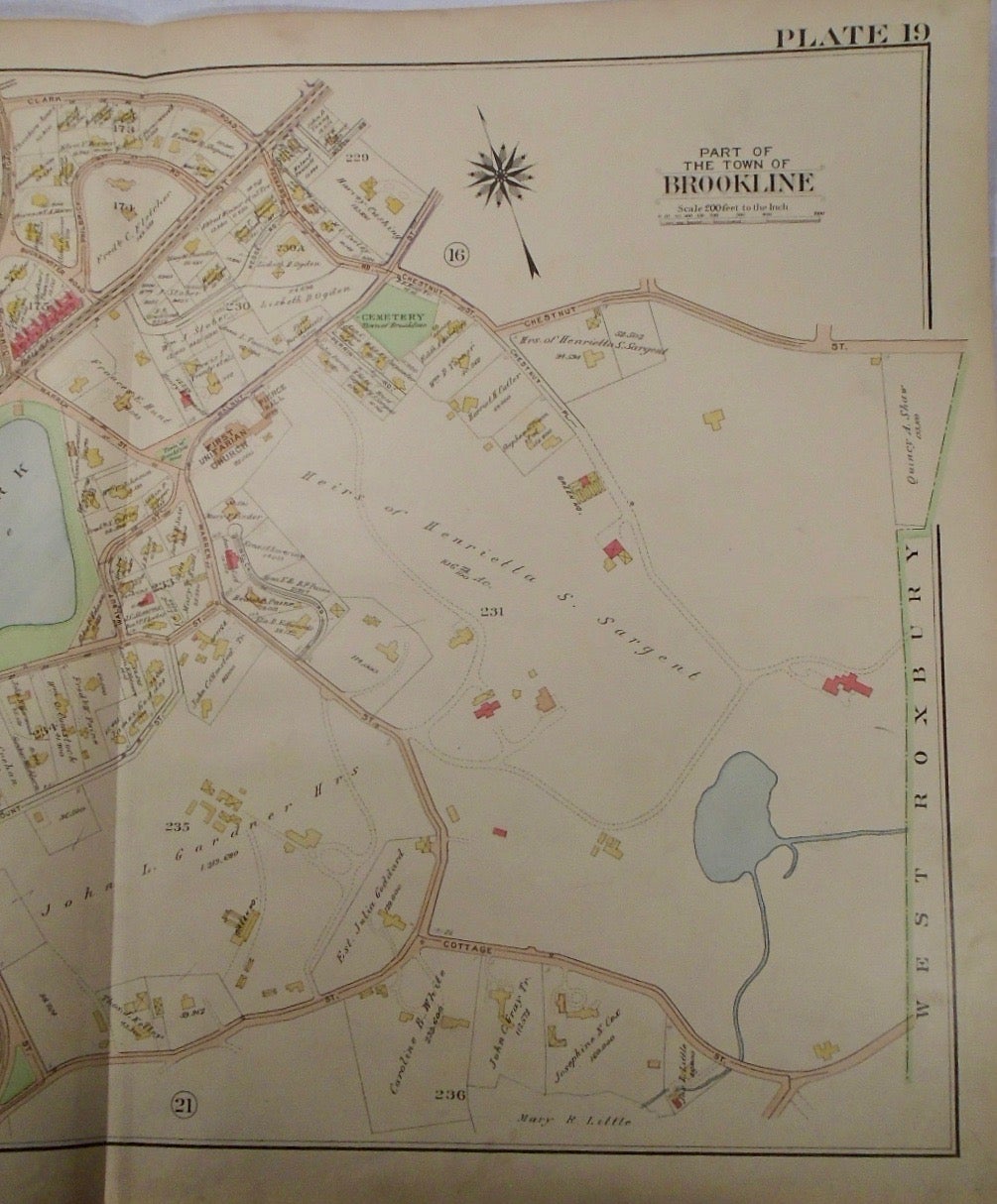
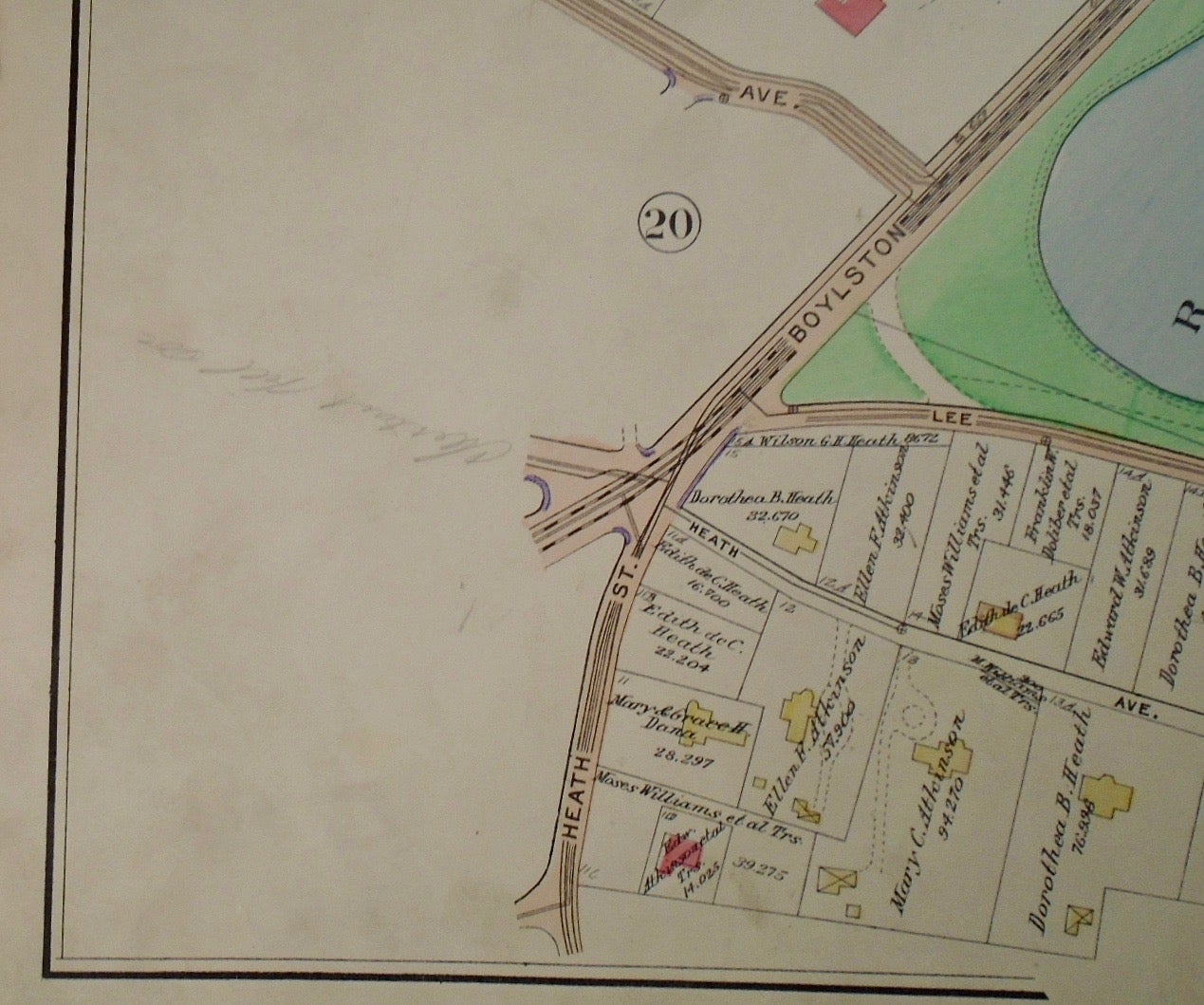
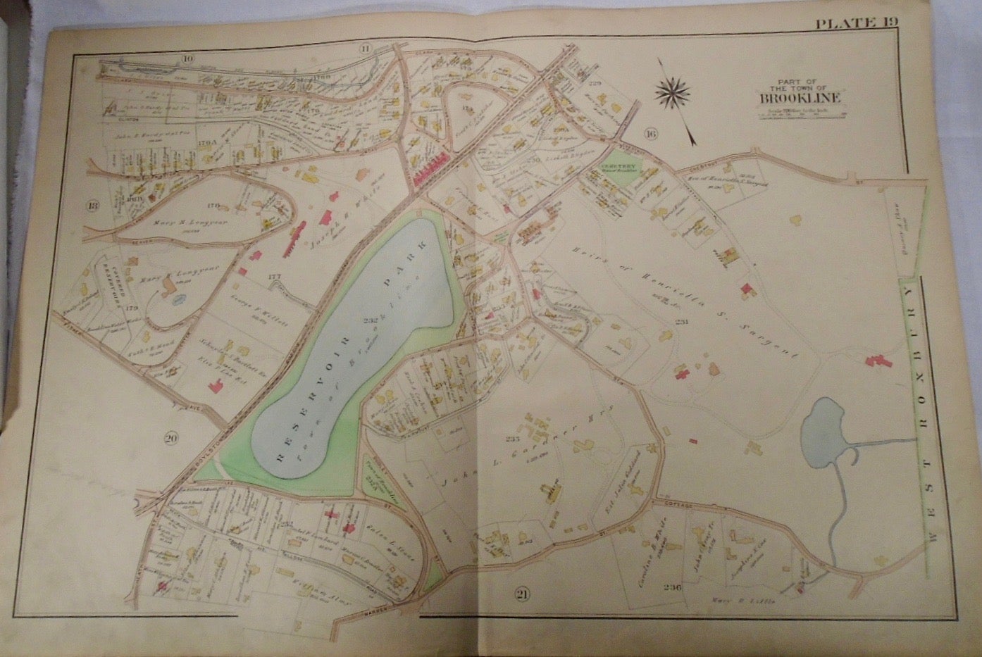
Map of Part of Brookline, Massachusetts. Philadelphia: G.W. Bromley & Co., 1913.
32.5x33. A partial, coloured and highly detailed map of Brookline with Reservoir Park. Clark Road and Chestnut Street to the North, West Roxbury to the East, Lee and Cottage Streets to the South, and private land to the West of Boylston Street.
Price: $100.00
See all items in
map
See all items by G. W. BROMLEY